
The Route
Difficulty: High (Includes steep ascents, steep descents and dangerous scrambles)
Trail Visibility: 80% on visible trails, but can be overgrown at times
Navigation: Difficult at first, but easy to remember
Time: 2.5x Standard Marathon Time
Distance: 39 km
Elevation Gain/Loss: 2900 m


The Background
When you sit back and feel that sensation in your stomach that something might be a bad idea, it generally is. But, I have seldom returned from a bad idea thinking it wasn’t worth it. Well, at least not for the first few days. It seems that almost always, sensational stories starts outside of our comfort zones.
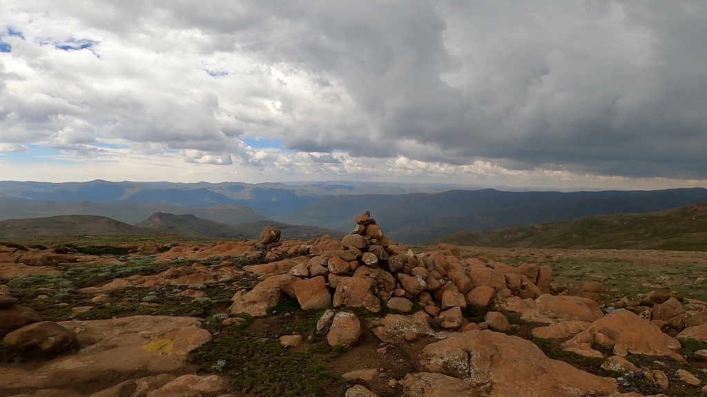
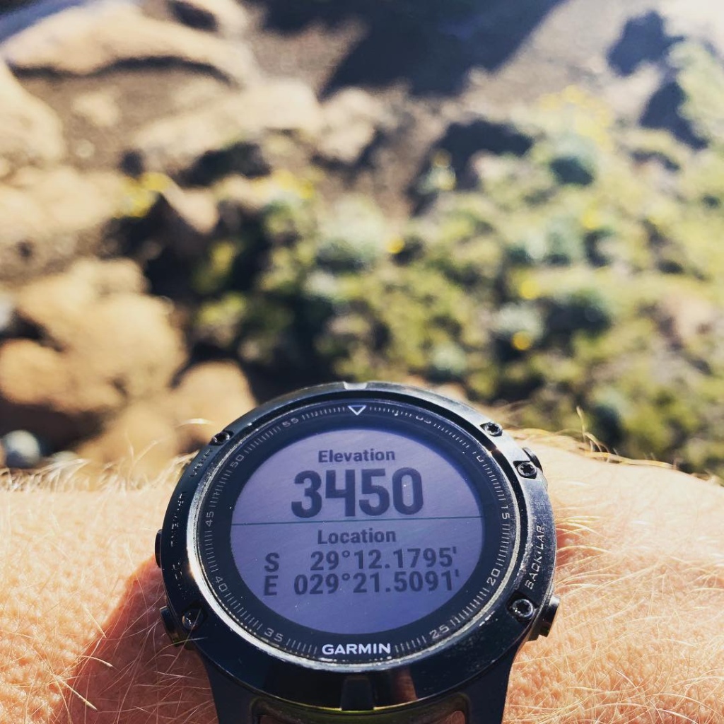
Ever since I started scratching the surface of running on trails I enjoyed going to the highest points. The best views perhaps? Yes, either that or that feeling that you’ve only really conquered a mountain once you’ve reached the very top. It was therefore inevitable that someday I would want to run to the highest point in South Africa, the mountain peak called Mafadi. Mafadi is located in the central part of the Maloti-Drakensberg Park World Heritage Site and can be accessed from numerous locations, the closest being Injishuti which forms part of the Ezemvelo KZN Wildlife area. Mafadi tops out at an altitude of 3450 meters above sea level. It is not a spectacular peak and gives you that deserted feeling of being in the middle of a moon landing mission rather than the top of a mountain. A few cairns here and there, a few rain puddles and a few patches of grass, that’s it really. Nonetheless, the GPS coordinates of S 029 12.1795’, E 029 21.5091’ gives you the highest altitude reading found anywhere in South Africa.
What Do You Need?
So, what do you need to run to Mafadi? Well, firstly, you will be walking more than running, but let’s call it a run and just don’t tell the world. Secondly, you need to have lost your mind already. No I’m just kidding, however, I don’t want people to assume it’s an easy hike, or jog, because if they do we might end up with a massacre of legs on the lower slopes towards Corner pass. Basically, you really need to have the stars aligned on the day, and don’t be stupid.
The Perfect Weather
As the saying goes, only fools and foreigners trust the weather forecasts. In three attempts to run to Mafadi I’ve only made it to the top once due to the weather not playing its part. My motto in the Drakensberg will always be that once the weather turns, I turn. The mountains will always be there, the weather not, so it really isn’t worth taking those Rambo risks.

The Gear, Food and Gadgets
For my latest run I have used the following:
- Trail running shoes
- Quick drying socks
- Running shorts
- A quick drying shirt
- An 8 liter running backpack
- Two 500 milliliter water flasks
- A fleece top and waterproof jacket
- A space blanket, whistle and a small piece of strapping
- A satellite messenger and tracking device
- A phone and GoPro
- A GPS watch with the planned route preloaded
- Three Snacker muesli bars, two packets of jelly teddies, a can of Redbull mixed with water and a Powerade. (Note that this was not nearly enough, plan better)
- A hat and some sunscreen.
I would consider adding;
- Running poles
- A breakfast at least
- Extra food
- Electrolyte tablets
- Coffee
- Leg sleeves and gloves if you don’t fancy the bundu-bashing battle scars
My Run
It all started in true Louis-fashion with horrible planning and impulsive decisions. I was in the Drakensberg area over the December holiday period and knew that I wanted to do a not-so-little training run up to the Mafadi peak, but, I didn’t have a date set for the attempt. So, after the first day of being in the mountains, at four o’clock in the afternoon and without having at least a few mountainous runs to wake up those climbing muscles, I decided to get it over and done with the following morning. As I didn’t pack any “race food” I popped into the local garage and found very limited options, much the same as with the Skyrun event a month earlier where I could also not find the basics in the small town of Lady Grey. I had an entire year to plan for that, I know. Nevertheless, I lumbered through the shop’s isles and took five Snacker bars, two packets of Energy jellies, two Redbulls and a Powerade. The one Redbull was more of a panic buy to be honest, as I knew I couldn’t carry three drinks from the start in only two water flasks. All good, I thought, one snack for roughly every hour. And then, at around eleven o’clock that night, it struck me; The hotel only serves breakfast at seven-thirty and I was planning on leaving at four.
As it turned out I had to sacrifice two of my Snacker bars and one packet of the energy jellies before the run even started. Remember what I said about not being stupid? That was now my unplanned breakfast-on-the-go as I drove from the hotel in Champagne Valley to Injishuti, about an hour’s drive. As I arrived at Injishuti there was no time for coffee as I was late yet again. I quickly filled up one water flask with a mixture of Redbull and water and the other with Powerade, knowing it would only last for the first stretch before switching to mountain water. After scribbling a lot of details into the mountain register I headed out of Injishuti just before six o’clock in the morning.
The first section I know by heart; Take the trail to the right just before the little concrete bridge; Turn left after crossing the river as it will loop around to the more runnable trail; Take the overgrown trail to the left after crossing the second river and avoid going straight. Although overgrown, the trail was still prominent about ten to fifteen meters away from the river bank, but it was slow. A saving grace perhaps for what was to come.
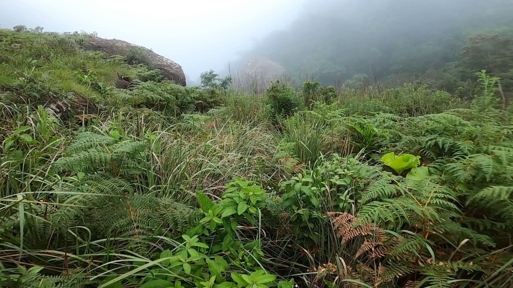
I started pretty casual and knowing the route meant I didn’t have to look at my watch for the first part of the trail, only to find out later that my watch had paused within the first few kilometres. Some Garmin glitch restarted the watch whilst navigating and it auto-paused. I now had to try and gauge how far I had gone with the watch being paused. I stumbled through this overgrown section and was properly soaked from the wet grass when I eventually reached the next river crossing ahead of the never-ending slopes that takes you up to Centenary Hut.

Cross the river quickly and tackle the climb straight away as the trail to the right was probably formed by one blind leading another. Both trails eventually join into one and there is no easy way to get from the river to Centenary Hut. The trail is perfect and the grass short, but the 30+ percent gradients are daunting (300 meters of vertical ascent in a kilometre that is). When you reach Centenary Hut you’ve made it halfway up the climb. However, the worst is still to come.
From Centenary Hut there are a few options, Judges pass, Corner pass or Around the Corner pass. I chose to head up straight, following the ridge-line path which, after a few scrambles, joins Corner pass from the side a fair way up already. It is also on this section where a briefly met a few Bloemfonteiners which were soon to discover that the earth is not that flat after all. Bloemfontein is part of the Platteland, directly translated as flat land. It has hectares and hectares of farmlands as far as the eye can see and the most beautiful African sunsets. Unfortunately, Corner pass is not the Platteland, it is quite the opposite. Gradients off the scale or an elevation gain of roughly 400 meters in a kilometre is what you can expect.


It is quite a narrow pass deserted with big loose boulders, but, once you’re in it you can’t really get lost. A large rock roughly halfway up usually has some water dripping from underneath, a handy water supply just before a little sketchy rock climb. No ropes required though, maybe just an extra pair of hands on a hike.

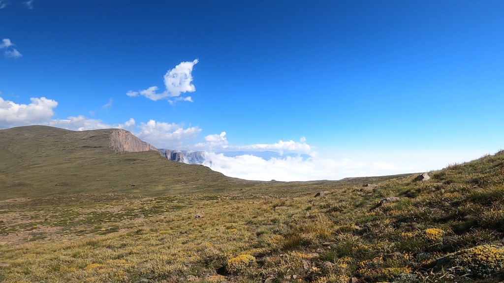
Back to the run, as I popped onto the escarpment, I could see Mafadi in the far distance. At this point Mafadi is not to be confused with Njesuthi Peak which is the one you’ll probably aim for if you don’t have a GPS track or map. At this point my watch started with its glitching problems again and I had to go into the engineering archives of my brain to try and figure out what my current running time was and where the landscape looked most Mafadi-like. I decided to just ignore the watch for the time being and headed into the direction of the highest peak, not dropping too far down the valley to avoid climbing back out, but also not running too much of a curve. I reached a strong river in the valley below and refilled my flasks and body with some ice-cold mountain water before heading back out of the valley on a proper trail leading towards Mafadi.
I reached the almost-top after touching the wrong cairn but my watch eventually lead me to the real Mafadi cairn and I was relieved to have finally conquered this run.
Or so I thought. Because, what laid in front of me was another twenty kilometres of downhill running and scrambling, a real quad burner. I wasn’t up for a speedy descent and just tried to keep the flow going, the same route, but in reverse. After finding the Bloemfonteiners, not far from where I’ve seen them originally, I was a bit confused. I discovered afterwards that they’ve gone horribly wrong in trying to find Around the Corner pass. That trail was visible from Corner pass but must have faded a little bit further away. I was relieved to see on their GPS data afterwards that they’ve tracked my direct approach and made it to the escarpment safely. For them, I must have been on the right place just at the right time. Coincidence? I don’t think so.

What happened to my food you might be wondering? Well, I forgot one of the Snacker bars in the car which left me with only two on the run. I ate those two bars and energy jellies in small chunks along the way, drank the Powerade within the first hour and kept on only refilling one flask with water, saving the Redbull mix for the climb up Corner pass. It was too little food and I could feel my energy levels dropping as I reached the valleys below on the way back. Oh, how relieved but also mad I was when I discovered that forgotten Snacker next to that optimistic Redbull in the car. Next time I will surely double check that everything is in the backpack before I start.
So briefly, what you need to run to Mafadi? A little bit of a plan, proper gear, some stuff to eat and a whole bucket full of faith. It is a difficult and dangerous run and should not be underestimated. It will take you about two or three times longer than your standard marathon time if your navigation is spot on. But hey, it is so bloody worth it.
That’s it, go out there and write your own little story.
’till next time,
Louis


Klink pretty sweet man!! Altyd cool om vir n klein rukkie die hoogste mens in n land te wees
LikeLike
[…] A run to the highest point in South Africa, Mafadi January 17, 2021 […]
LikeLike